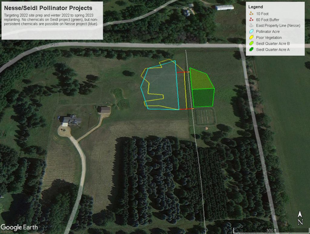
A good place for our planning to start seemed to be deciding where to put the plot. We started by outlining an area of our property that produces poor vegetation – which we define as harboring a high percentage of invasive plants such as thistle, spotted knapweed, and mullein. Ted used a mapping app he developed a while back for Karl to identify the area shown in yellow outline. Then we took inventory of the types of plants that were growing there initially – many thanks to Karin Jokela for help identifying our rogue’s gallery:
- Kentucky Bluegrass
- Clover
- Canadian Thistle
- Bull Thistle
- Timothy Grass
- Creeping Cinquefoil
- Dandelion
- Plumeless Thistle
- (Other) Thistle
- Mullein
- Spotted Knapweed
- Ox Eye Daisy
- Foxtail
- Goldenrod
- Sedge
- Yellow Rocket
- Yarrow
- Stinging Nettle
- Horseweed/Fleabane
- Moss
- Mouse-eared Chickweed
Then we collaborated with neighbor Jim to establish a shape that would work well with a possible plot development on his property. We set our size somewhat arbitrarily at 1 acre, and set to work. There is an organic food forest developed just south of the green outline, and we agreed to maintain a 50′ buffer zone since we anticipated using chemicals to start the development of our plot. Ted got to work with Google Earth, and the blue outline is the final plot area we selected, after several iterations. (If you ask me, I’ll say I don’t use any Google products owing to my “foil hat” paranoia. But the fact is, Google has some irresistible tools.)
Ted outlined a plan for site preparation, planting and maintenance and we got some great feedback from Tara Kelly (Washington County Conservation District), and Karin Jokela (The Xerces Foundation). Additionally, Eric Lindberg of SmileyAnts.org (a former neighbor) was kind enough to stop over and review our sites and plans. Once all that input was stirred into our plans, we felt we had enough to proceed.
Next: Initial Site Preparation